Another dose of rocks at Golfe du Morbihan
Into the Golfe du Morbihan
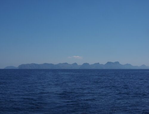
A short and unremarkable sail took us from La Trinité-sur-Mer around the Locmariaquer peninsula and into the Golfe du Morbihan, a shallow maze of islands, rocks and channels. The Golfe du Morbihan, according to some, is one of France’s premier cruising grounds. Each to their own, I guess, but its somewhat cramped waterways are certainly extraordinarily popular with boaters of all flavours and it is certainly pretty, in a rural French kind of way.

The approach to the Golfe du Morbihan.
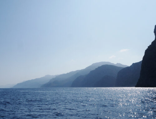
Our destination was an anchorage on the western end of the Golfe du Morbihan between Île Longue and Gavrinis. From this very pleasant anchorage we spent a couple of days taking in Neolithic sites and exploring the countryside on our bikes. Evenings were calm and glassy with glowing orange sunsets and bright moonlit nights.


Gorgeous views of sunsets and moonrises from our anchorage.
When floating keyrings don’t float…
While the location was pleasant, things got off to a bit of poor start when, as Frederieke climbed out of the dinghy at the jetty in Larmor-Baden, she dropped her keys overboard. Down they went through 3m of beautifully clear water and into the weeds on the bottom. The wonderfully red but previously untested float that was meant to keep the keys on the surface contrasted beautifully with the various shades of kelp green and shimmered teasingly at us through the water. For some reason Frederieke was unwilling to simply strip down and plunge into the decidedly chilly water to rescue her keys, so there followed a half hour of mucking around with sticks and poles before keys were rescued and equanimity was restored.
(obviously, no photos of this ‘incident malheureux’)
More tumuli, dolmens and menhirs!
A mile or so to the west of our anchorage was the Locmariaquer peninsula. This is a prime spot for leisurely cycling with quiet country lanes and paths, pleasant forests, beaches and cultural sites distributed across the peninsula at easy distances. Happily, these cultural sites included an abundance of tumuli, dolmens and menhirs, and as such, provided a continuation of our rock-theme for our wanderings there.


The dolmen ‘Table des Marchand’, and its entrance passage.
The great expanses of time over which these neolithic remains have sat in this landscape, long predating even the earliest ancestors of the current occupants, has meant that these ancient remains are simply part of the landscape for the locals, no different to the hills and dales in which they are found, and so these sites have been incorporated into everyday life.

A random dolmen somewhere on the Locmariaquer peninsula.
Consequently, they can be found in what to outsiders might seem to be odd locations; someone’s back yard, a field or at a crossroad.


The inside of a dolmen, somewhere in someone’s backyard.
Many of the most imposing sit in what clearly were once positions with commanding views out over what would have been the valleys and lowlands of Morbihan before sea level rise turned them into waterfront locations.


Le Grand Menhir brisé, or, the large broken menhir. When it was still standing up, it measured 20.6 m and weighed 330,000 kg.
The Gavrinis tumulus
Immediately east and less than a mile away from our anchorage was Gavrinis. On the southern tip of the island is one of the better preserved and decorated tumuli. Still partially earth covered (or perhaps re-covered), the Gavrinis tumulus is a terraced mound perhaps 8m high and maybe 25m long and 15m wide. A single passage opens on the southern and water facing side. At the time of its construction, this entrance would have faced a shallow but wide valley occupied by the forests, fields and the villages of its builders but now it looks out over an expanse of water, islands and a horde of French recreational boaters.

The mound that is the Gavrinis tumulus.
The passage entrance to the Gavrinis tumulus has been reconstructed to what someone or other in recent times thought it might have looked like. Did they get it right? Seems like a reasonable guess but who knows.


The entrance to Gavrinis, with our guide.
The fact that rocks lining the passage walls and ceiling are extensively carved, as is the burial chamber itself, suggests that the passage would have been used more than once and thus that there was probably a need for an actual entrance to the mound.

The passage in the Gavrinis tumulus.
The one they’ve built matches the passage construction so it’s probably not too far off the original. But then again, perhaps the original entrance was closed up with a dry stone wall when not in use and no formal entrance was required. Who knows.
Spectacular rock carvings
Once inside the tumulus the walls of both the long entry passage and the burial chamber itself are extensively decorated with intriguing carvings.


Some of the spectacular rock carvings inside the passage.
This is a pretty clear indication that not only did this civilization have the spare time and energy to haul rocks weighing tons from significant distances for use in their constructions, but that they were willing to then also spend the time chipping away at hard granite surfaces with rock, or perhaps early metals (not sure that there is evidence of this), to make those rocks a bit pretty and special.


More rock carvings from the passage in Gavrinis. Now, are those holes handholds to carry one’s rockslab around with…??
Getting buried is, of course, a special occasion for the internee and those around them but we are talking huge amounts of time and effort to do this. Clearly death was not only special for these people but not entirely final either.
Underwater menhirs
A dinghy ride to the south of us, and directly in front of the Gavrini tumulus, lay a small island on what would have been a hill on the opposite side of the river. Here, on the southern side of the hill top, a stone alignment marches down into and under the water in two long arms stretched out at 60˚ to each other.

The ‘Cromlec de Er Lannic’, the stone circle of Er Lannic, nearby Gavrinis.
Four thousand years ago this alignment would have been on a hilltop looking out over the flat lands below. Sitting in the dinghy we could see the submerged menhirs, each successive one more dimly through the water than the last. This would have been a prime snorkeling or diving site, except that this was obviously not permitted, so we admired the scenery from the surface.

A prime snorkelsite, but alas, inwater activities with the menhirs are not permitted
Onto the next marché
Following this overdose of rocks, combined with an increasingly empty fridge, we decided to go a bit further upstream to go and check out the marché in the nearest town Vannes.


😁 mooi. Wat een mooi leven hebben jullie toch.
Ja, geweldig hè, ‘t kon minder!